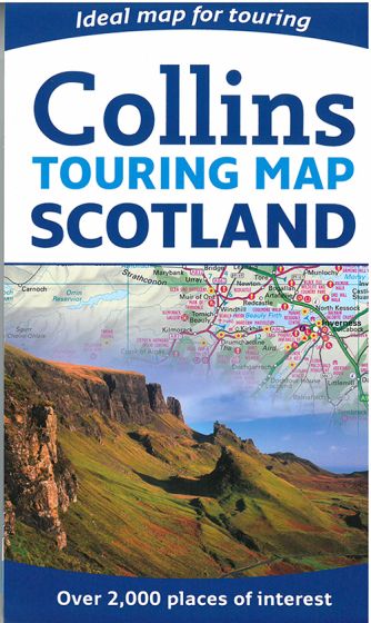
Scotland Touring Map
95,00 kr
Udsolgt. Fås i anden udgave.
ISBN
9780007545414
Revised edition 2014.
This clear, easy to follow road map with color classified roads shows distances shown along major routes. The attractive hill shading shows the shape of the landscape, and a comprehensive index of place names is included. Hundreds of places of tourist interest have been plotted and named on the map in 25 categories, including youth hostels, picnic sites, and ferries, as well as the more obvious tourist sites such as castles, wildlife parks, and museums.
Detailed town center maps are highlighted, including Edinburgh, Glasgow, and Aberdeen. This map contains everything for the traveler who wishes to explore this beautiful country.
Scale 1:316.800.
| Forlag | Collins |
|---|---|
| Varegruppe | Maps & Guides |
| Ekspedition | SVB |
| Udgivelsesdato | 13. mar. 2014 |
| Sideantal | 0 |
| Bredde | 0 |
| Højde | 0 |
| Dybde | 0 |
| Vægt | 0 |
| Første udgave | 2014 |
| Oplagsdato | 13. mar. 2014 |
| Oplag | 0 |
| Udgave | 0 |
| ISBN-13 | 9780007545414 |
| ISBN-10 | 000754541X |
| EAN | 9780007545414 |
| Sprog | Engelsk |
| Orignalsprog | Sproget kan ikke bestemmes |
| Illustreret i farver/sh | Nej |

