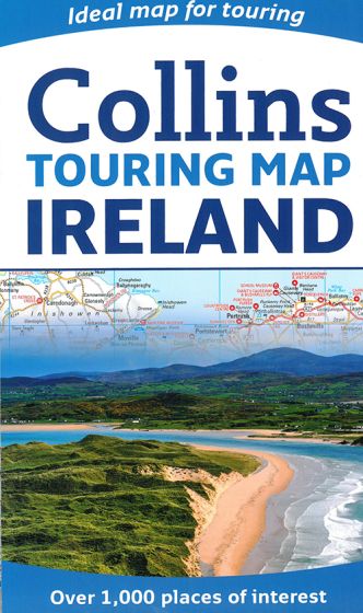
Ireland Touring Map
95,00 kr
På lager
ISBN
9780008183738
Large full colour Collins map of the whole of Ireland showing the road network in detail, and with a special emphasis on places of tourist interest. This map has a handy touring scale of 1:475.200. It has over 20 categories of tourist information depicted on the map with clear, colourful red and yellow symbols. There is a full index to place names and places of interest. INCLUDES: - All classified and most minor roads. - Railway network and ferry routes. - Viewpoints and sandy beaches. - Speed enforcement zones and safety camera locations. - Index to 20 categories of tourist information. - Includes castles, historic houses, gardens, beaches and golf courses.
| Forfatter | Collins |
|---|---|
| Forlag | Collins |
| Indbinding | Falset |
| Thema koder | Irland, Turistkort |
| Varegruppe | Maps & Guides |
| Ekspedition | SVB |
| Udgivelsesdato | 9. mar. 2017 |
| Sideantal | 0 |
| Bredde | 0 |
| Højde | 0 |
| Dybde | 0 |
| Vægt | 0 |
| Første udgave | 2017 |
| Oplagsdato | 9. mar. 2017 |
| Oplag | 0 |
| Udgave | 0 |
| ISBN-13 | 9780008183738 |
| ISBN-10 | 0008183732 |
| EAN | 9780008183738 |
| Sprog | Engelsk |
| Orignalsprog | Sproget kan ikke bestemmes |
| Illustreret i farver/sh | Nej |
Bøger i samme varegruppe: