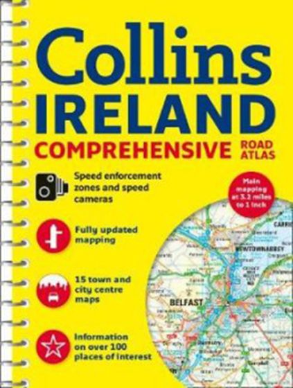
Ireland Comprehensive Road Atlas
158,75 kr
På lager
ISBN
9780008270339
Clear, detailed road atlas of Ireland in a handy A4 spiral-bound format. This comprehensive, general purpose road atlas of the whole of Ireland is ideal for both business and pleasure use. The atlas contains a range of mapping scales: 9 miles to 1 inch route planning map. Main maps at 3.2 miles to 1 inch, which are ideal for navigation. A wide selection of detailed town centre street plans. This 2018 edition boasts road mapping packed with detail - showing colour classified road network, toll roads, land heights, the location of safety cameras, Blue Flag and Green Coast beaches, tourist information centres and a wide range of tourist attractions. There is also comprehensive guide information for visitors to Belfast, Cork, Dublin and Limerick. The locations of Speed Enforcement Zones, which highlight roads that have a high risk of accidents as identified by the Garda and the National Roads Authority, are included. There is also a wide range of fully indexed town and city centre maps. These are: Bangor, Belfast, Cork, Drogheda, Dublin, Dun Laoghaire, Galway, Kilkenny, Killarney, Limerick, Lisburn, Londonderry (Derry), Newry, Newtownabbey and Waterford.
| Forfatter | Collins |
|---|---|
| Forlag | Collins |
| Indbinding | Spiralryg |
| Thema koder | Bilatlas og vejkort, Irland |
| Varegruppe | Maps & Guides |
| Ekspedition | SVB |
| Udgivelsesdato | 8. feb. 2018 |
| Sideantal | 160 |
| Bredde | 0 |
| Højde | 0 |
| Dybde | 0 |
| Vægt | 0 |
| Første udgave | 2018 |
| Oplagsdato | 8. feb. 2018 |
| Oplag | 0 |
| Udgave | 0 |
| ISBN-13 | 9780008270339 |
| ISBN-10 | 0008270333 |
| EAN | 9780008270339 |
| Sprog | Engelsk |
| Orignalsprog | Sproget kan ikke bestemmes |
| Illustreret i farver/sh | Nej |
Bøger i samme varegruppe: