Denver Regional Map
98,75 kr
På lager
ISBN
9780528007576
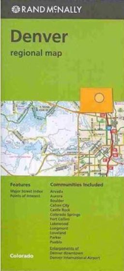
Rand McNally's folded map for Denver is a must-have for anyone traveling in and around this part of Colorado, offering unbeatable accuracy and reliability at a great price. Our trusted cartography shows all Interstate, U.S., state, and county highways, along with clearly indicated parks, points of interest, airports, county boundaries, and streets. The easy-to-use legend and detailed index make for quick and easy location of destinations. You'll see why Rand McNally folded maps have been the trusted standard for years. Regularly updated Full-color maps Clearly labeled Interstate, U.S., state, and county highways Indications of parks, points of interest, airports, county boundaries, downtown & vicinity maps Easy-to-use legend Detailed & full street index Enlargements of Denver Downtown and Denver International Airport Convenient folded size Communities Included: Arvada, Aurora, Boulder, Canon City, Castle Rock, Colorado Springs, Fort Collins, Lakewod, Longmont, Loveland, Parker, Pueblo
| Forlag | Rand McNally |
|---|---|
| Thema koder | Bykort, Colorado |
| Varegruppe | Maps & Guides |
| Ekspedition | SVB |
| Udgivelsesdato | 15. dec. 2016 |
| Sideantal | 0 |
| Bredde | 0 |
| Højde | 0 |
| Dybde | 0 |
| Vægt | 0 |
| Første udgave | 2016 |
| Oplagsdato | 15. dec. 2016 |
| Oplag | 0 |
| Udgave | 0 |
| ISBN-13 | 9780528007576 |
| ISBN-10 | 0528007572 |
| EAN | 9780528007576 |
| Sprog | Engelsk |
| Orignalsprog | Sproget kan ikke bestemmes |
| Illustreret i farver/sh | Nej |
Bøger i samme varegruppe: