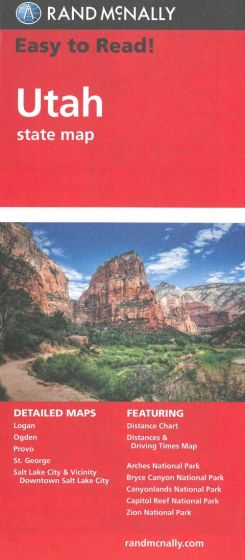
Utah State Map
87,50 kr
På lager
ISBN
9780528882081
Rand McNally's folded map for Utah is a must-have for anyone traveling in or through the state, offering unbeatable accuracy and reliability at a great price. Our trusted cartography shows all Interstate, U.S., state, and county highways and much more.
Points of interest
State park chart
State mileage chart
Driving times map
On-the-road toolbox
Visitor center information
Climate data
State facts & symbols
Easy-to-use legend
Detailed indexed
Points of interest
State park chart
State mileage chart
Driving times map
On-the-road toolbox
Visitor center information
Climate data
State facts & symbols
Easy-to-use legend
Detailed indexed
| Forfatter | Rand McNally |
|---|---|
| Forlag | Rand McNally |
| Indbinding | Falset |
| Thema koder | Bilatlas og vejkort, Utah |
| Varegruppe | Maps & Guides |
| Ekspedition | SVB |
| Udgivelsesdato | 1. mar. 2010 |
| Sideantal | 0 |
| Bredde | 0 |
| Højde | 0 |
| Dybde | 0 |
| Vægt | 0 |
| Første udgave | 2010 |
| Oplagsdato | 1. mar. 2010 |
| Oplag | 0 |
| Udgave | 0 |
| Serie | Rand McNally |
| ISBN-13 | 9780528882081 |
| ISBN-10 | 0528882082 |
| EAN | 9780528882081 |
| Sprog | Engelsk |
| Orignalsprog | Sproget kan ikke bestemmes |
| Illustreret i farver/sh | Nej |
Bøger i samme varegruppe: