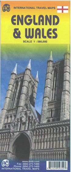
England & Wales
118,75 kr
På lager
ISBN
9781553419327
This map covers all of England and Wales on a double-sided map, showing motorways, divided carriageways, all A & B highways, railway lines, airports, historic sites and touristic attractions, parks and gardens, and just about everything that we could fit on to the page to provide users with a detailed, usable map. Insets os the Scilly Islands and the Balliwicks of Jersey and Guernsey are included, and the map is place-name indexed.
| Forfatter | ITM Publications |
|---|---|
| Forlag | ITMB publishing |
| Indbinding | Falset |
| Varegruppe | Maps & Guides |
| Ekspedition | SVB |
| Udgivelsesdato | 1. nov. 2014 |
| Sideantal | 0 |
| Bredde | 0 |
| Højde | 0 |
| Dybde | 0 |
| Vægt | 0 |
| Første udgave | 2014 |
| Oplagsdato | 1. nov. 2014 |
| Oplag | 0 |
| Udgave | 2 |
| Serie | International Travel Maps |
| ISBN-13 | 9781553419327 |
| ISBN-10 | 1553419324 |
| EAN | 9781553419327 |
| Sprog | Engelsk |
| Orignalsprog | Sproget kan ikke bestemmes |
| Illustreret i farver/sh | Nej |
Bøger i samme varegruppe: