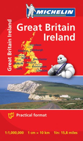
Great Britain & Ireland Mini Map
48,75 kr
Kan leveres sidst i januar.
ISBN
9782067193116
Michelin mini map Great Britain & Ireland scale 1/1,000,000 will give an overall picture of your route with concise road and travel information.
Small and practical, this map is easy to use thanks to double sided pocket format and includes multi-language key, relief shading, spot heights and other geographical features. Ferry connections are marked but railways are not included.
Updated annually, this map is cross-referenced with Michelin Green Guide.
Small and practical Michelin mini maps feature: Primary and secondary road network, including Ferry connections.
Geographic features: relief, spot heights.Tourist information/ places of interest.
Double sided format.
Multi-language key.
| Forfatter | Michelin |
|---|---|
| Forlag | Michelin |
| Indbinding | Falset |
| Thema koder | Irland, Storbritannien, Turistkort |
| Varegruppe | Maps & Guides |
| Ekspedition | SVB |
| Udgivelsesdato | 12. nov. 2013 |
| Sideantal | 0 |
| Bredde | 0 |
| Højde | 0 |
| Dybde | 0 |
| Vægt | 0 |
| Første udgave | 2013 |
| Oplagsdato | 12. nov. 2013 |
| Oplag | 0 |
| Udgave | 0 |
| Serie | Michelin Mini Map |
| ISBN-13 | 9782067193116 |
| ISBN-10 | 2067193112 |
| EAN | 9782067193116 |
| Sprog | Engelsk |
| Orignalsprog | Sproget kan ikke bestemmes |
| Illustreret i farver/sh | Nej |


