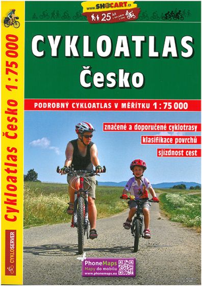
Cykloatlas Cesko - Cycling Atlas Czech Republic
358,75 kr
På lager
ISBN
9788072246267
This spiral-bound atlas in scale 1:75.000 offers complete map coverage of the Czech Republic. The maps show the marked/named bike paths, mountain bike paths, several levels of roads, from highways to dirt paths passable only when dry, one way paths, dangerous points where paths cross roads, and much more. Numerous symbols locate tourist sites and services, including historical sites, hotels, gas stations, medical services, and much more. The maps are fully topographic with extensive elevation detail. In Czech with an English and multi-lingual legend and description of all of the symbols used on the maps.
| Forlag | Freytag & Berndt |
|---|---|
| Thema koder | Cykling: generelt og cykelture, Tjekkiet |
| Varegruppe | Maps & Guides |
| Ekspedition | SVB |
| Udgivelsesdato | 1. feb. 2017 |
| Sideantal | 328 |
| Bredde | 0 |
| Højde | 0 |
| Dybde | 0 |
| Vægt | 0 |
| Første udgave | 2017 |
| Oplagsdato | 1. feb. 2017 |
| Oplag | 0 |
| Udgave | 0 |
| ISBN-13 | 9788072246267 |
| ISBN-10 | 8072246267 |
| EAN | 9788072246267 |
| Sprog | flere sprog |
| Orignalsprog | Sproget kan ikke bestemmes |
| Illustreret i farver/sh | Nej |
Bøger i samme varegruppe: