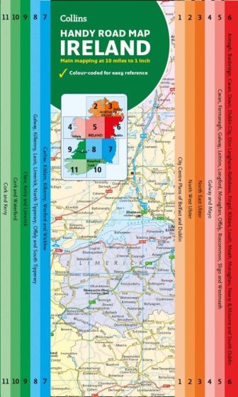
Ireland Handy Road Map
78,75 kr
På lager
ISBN
9780008369989
Easy-to-use route-planning map covering the whole of Ireland opens almost like a book. It has the convenience of an atlas with all the benefits of a fold out map, and features clear, full-colour road maps at 1:625.000 plus city centre plans of Belfast and Dublin.
The map is laminated on both sides making it very hard wearing and comes in a plastic wallet.
Features include:
- Clear detailed mapping with attractive layer colours showing height
- Places of tourist interest and Tourist Information Centres shown
- Distance chart on the back of the map in both miles and kilometres
- Distances shown on the roads to aid journey planning
| Forfatter | Collins |
|---|---|
| Forlag | Collins |
| Indbinding | Falset |
| Thema koder | Irland, Nordirland, Turistkort |
| Varegruppe | Maps & Guides |
| Ekspedition | Scanvik |
| Udgivelsesdato | 6. feb. 2020 |
| Sideantal | 0 |
| Første udgave | 0 |
| Oplagsdato | 6. feb. 2020 |
| Oplag | 0 |
| Udgave | 0 |
| ISBN-10 | 0008369984 |
| EAN | 9780008369989 |
| Sprog | Engelsk |
| Illustreret i farver/sh | Nej |
Bøger i samme varegruppe: