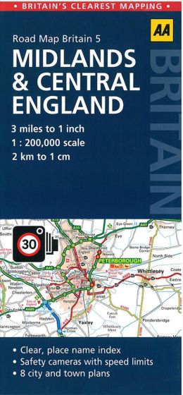
Midlands & Central England
88,75 kr
Mangler for tiden på forlagets lager. Leveringstid ukendt.
ISBN
9780749577148
AA Road Map Midlands & Central England is a practical and slimline, foldable map from the experts at the AA. Encased in a durable, weatherproof cover, the mapping is produced at a scale of 3 miles to 1 inch (1:200,000 / 2km to 1cm) combining clear design, an easy-to-read scale and more road detail to ensure that you never lose your way. Also included are toll points, service areas, road numbers, motorways, dual carriageways and wide narrow local roads, National Parks and other places of interest.
| Forfatter | AA |
|---|---|
| Forlag | AA Publishing |
| Indbinding | Falset |
| Thema koder | Midlands, Turistkort |
| Varegruppe | Maps & Guides |
| Ekspedition | SVB |
| Udgivelsesdato | 7. jul. 2015 |
| Sideantal | 0 |
| Bredde | 0 |
| Højde | 0 |
| Dybde | 0 |
| Vægt | 0 |
| Første udgave | 2015 |
| Oplagsdato | 7. jul. 2015 |
| Oplag | 0 |
| Udgave | 0 |
| Serie | AA Road Map Britain |
| ISBN-13 | 9780749577148 |
| ISBN-10 | 0749577142 |
| EAN | 9780749577148 |
| Sprog | Engelsk |
| Orignalsprog | Sproget kan ikke bestemmes |
| Illustreret i farver/sh | Nej |


