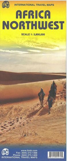
Africa Northwest
110,00 kr
På lager
ISBN
9781553415275
Double-sided with the western coastal segment on one side and the eastern half on the other. The coverage of the map is from Morocco in the west to the Libyan/Egyptian border and from Senegal and Liberia in the southwest to the Chad/Sudan border in the southeast.
Legend includes: Road by classification, motorways, main roads, secondary road, railway, international airports, castles, ruins, waterfalls, border crossing, point of interests and much more.
The scale is 1:3,8 mio.
Legend includes: Road by classification, motorways, main roads, secondary road, railway, international airports, castles, ruins, waterfalls, border crossing, point of interests and much more.
The scale is 1:3,8 mio.
Forlag | ITMB publishing |
---|---|
Thema koder | Afrika, Turistkort |
Varegruppe | Maps & Guides |
Ekspedition | SVB |
Udgivelsesdato | 8. jan. 2014 |
Sideantal | 0 |
Bredde | 0 |
Højde | 0 |
Dybde | 0 |
Vægt | 0 |
Første udgave | 2014 |
Oplagsdato | 8. jan. 2014 |
Oplag | 0 |
Udgave | 1 |
Serie | International Travel Maps |
ISBN-13 | 9781553415275 |
ISBN-10 | 1553415272 |
EAN | 9781553415275 |
Sprog | Engelsk |
Orignalsprog | Sproget kan ikke bestemmes |
Illustreret i farver/sh | Nej |
BoghandelensVaregruppe | Maps & Guides | ![]() |
---|---|---|
EkspeditionsID | 398 | ![]() |
Varetype | 3 | |
Materialekode | Ikke relevant | |
EANBeregnet | 9781553415275 | ![]() |
ISBN | 978-1-55341-527-5 | |
BOPISBN13 | 9781553415275 | |
Bogklubbog | ikke bogklubbog/vare. | |
Subskriptionsbog | ikke subskriptionsbog | |
Er varen til videresalg | Yes | ![]() |
Titel | Africa Northwest | ![]() |
Varetekst | Africa Northwest; International Travel Maps | ![]() |
Varetekst_Låst | Nej / ikke låst | |
Serietitel | International Travel Maps | ![]() |
EkspeditionsVaretekst | ITM Publications, Africa Northwest, International Travel Maps | ![]() |
Ombyttes | No | |
Kan returneres | No | |
Kædetitel | False | |
Forlagstekst | Double-sided with the western coastal segment on one side and the eastern half on the other. The coverage of the map is from Morocco in the west to the Libyan/Egyptian border and from Senegal and Liberia in the southwest to the Chad/Sudan border in the southeast. Legend includes: Road by classification, motorways, main roads, secondary road, railway, international airports, castles, ruins, waterfalls, border crossing, point of interests and much more. The scale is 1:3,8 mio. | ![]() |
ForlagsNavn | ITMB publishing | ![]() |
Indbindingsform | 79 | ![]() |
Område | Afrika | |
Målestok | 1:3.800.000 | ![]() |
LandId | 148 | |
Billede | jpg | ![]() |
Sidste ændring for billede | 2014-02-06 00:00:00 | |
Decimalklasse | 48.41 | |
ThemaKode | WTRM¤1H | |
ThemaDBC | Forlaget | |
Udgave | 1 | |
ÅrForSenesteOplag | 2014 | ![]() |
ÅrForUdgave | 2014 | ![]() |
Udgivelsesdato | 2014-01-08 | ![]() |
Udgivelsesland | -1 | |
Hovedsprog | eng | |
SprogOriginaludgaven | und | |
Materialet sprog | und | |
Oprettet | 2014-01-30 | |
DagForSenesteÆndring | 2017-11-01 | |
Festskrift | ikke festskrift | |
Stor skrift | almindelig skriftstørrelse | |
Katalogiseringsniveau | Katalogisering, selvsyn | |
Mellemoriginalens sprog | und | |
SprogIResumeer | und | |
Sprog_I_Undertekster | und | |
Udgivelsesår |
Bøger i samme varegruppe: