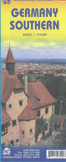
Germany Southern
110,00 kr
På lager
ISBN
9781771293099
2nd edition 2016. The area of the coverage is from Köln in the north to the Swiss/Austrian borders in the south and east, and from the Rhine River in the west to Passau in the east. There is a little space left over to show surrounding countries, but Aachen, Strasbourg, Basel and Salzburg are noted on the map. We have also simplified road classifications, using bluish violet for motorways as this color stands out, green for major highways and white for connecting roads Germany is Europe's most densely populated country and is loaded with historic town centres (called Aldstadts), cathedrals, castles, walled towns, and medieval buildings. The scale is 1:415.000.
| Forlag | ITMB publishing |
|---|---|
| Thema koder | Turistkort, Tyskland |
| Varegruppe | Maps & Guides |
| Ekspedition | SVB |
| Udgivelsesdato | 15. jun. 2016 |
| Sideantal | 0 |
| Bredde | 0 |
| Højde | 0 |
| Dybde | 0 |
| Vægt | 0 |
| Første udgave | 2016 |
| Oplagsdato | 15. jun. 2016 |
| Oplag | 0 |
| Udgave | 2 |
| Serie | International Travel Maps |
| ISBN-13 | 9781771293099 |
| ISBN-10 | 1771293098 |
| EAN | 9781771293099 |
| Sprog | Engelsk |
| Orignalsprog | Sproget kan ikke bestemmes |
| Illustreret i farver/sh | Nej |


